




A potentially history-making El Niño is building across the equatorial Pacific. From Manila to Lima, from Sydney to Nairobi, the same ocean anomaly will deliver opposite disasters — floods and fires, droughts and deluges — stitched together by a single seesaw of warm water.
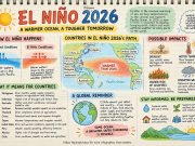
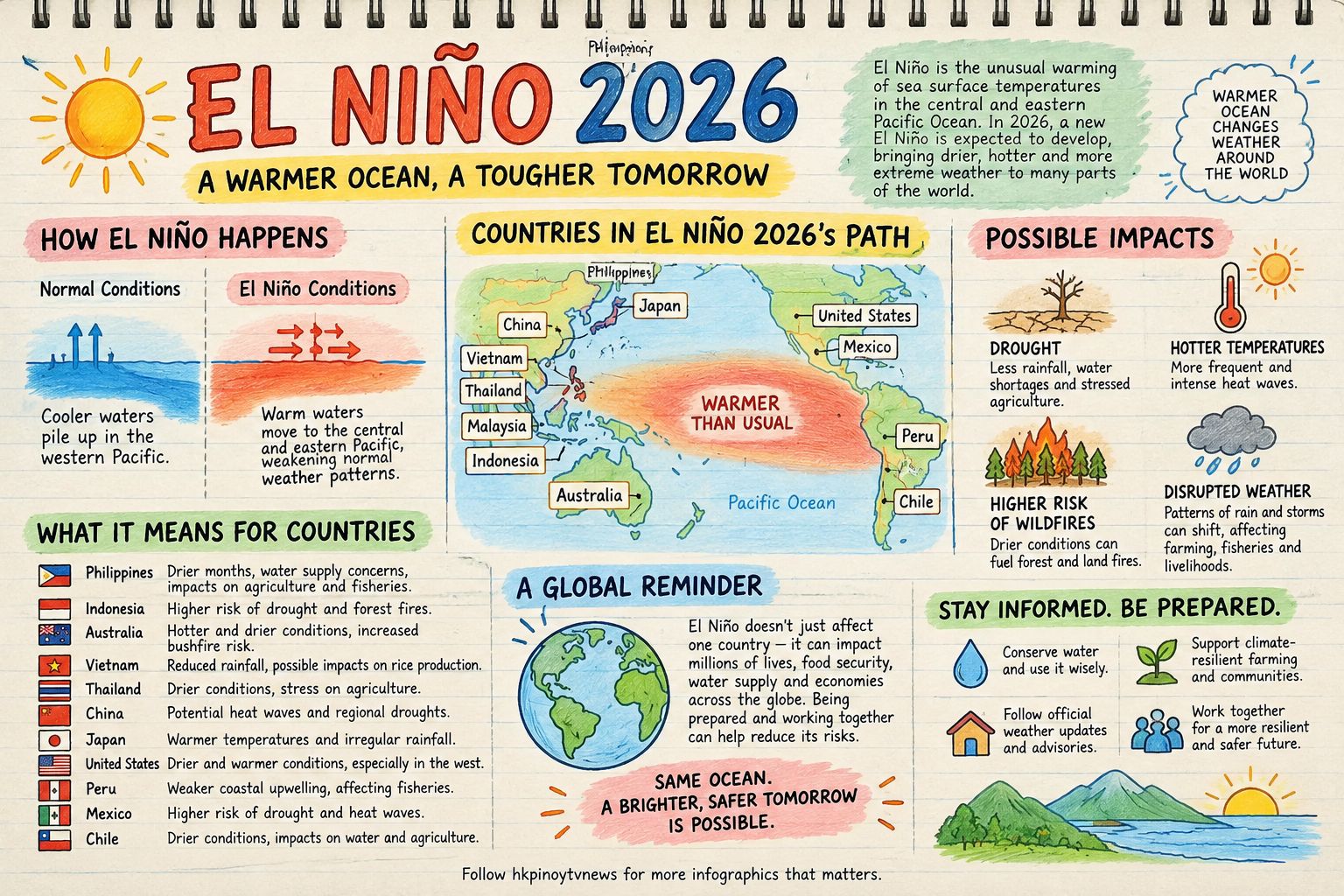
Every few years, the Pacific Ocean rearranges the planet’s weather. When the trade winds that normally push warm surface water westward toward Asia weaken, that warmth sloshes east toward South America. Rain clouds follow. The result — El Niño — is not a local storm but a planet-scale reorganization of rainfall, heat, and storm tracks that touches virtually every economy on Earth.
The 2026 event now unfolding is exceptional in the statistical record. The phase state was established in late August with a relative Niño3.4 index of +1.8°C; by mid-September the index had hit +3.0°C with subsurface heat surging. NOAA assigns a 75 percent chance of a historic event during October–December 2026, and Columbia University’s IRI reports that all 22 forecast models agree on further strengthening to a November–December peak. The Hong Kong Observatory confirms the event persisted through fall with a high likelihood of extension into spring 2027.
Asia and the Pacific Rim: the dry side of the seesaw
The Philippines — covered in detail elsewhere in this series — absorbs El Niño’s rainfall suppression in its agriculture (₱6.87 billion in damage in the DA’s first September tally), water supply (Angat Dam’s record low in July), and hydropower (Mindanao’s grid under repeated red alerts in September).
Indonesia and Malaysia face perhaps the region’s most volatile El Niño risk: fire. Drought interacting with degraded peatlands and forest clearance produces wildfire seasons that have historically blanketed Southeast Asia in transboundary haze, triggering school closures, flight disruptions, and public health emergencies across Singapore and southern Thailand. The ASEAN Climate Outlook Forum has flagged this year as particularly concerning, with agricultural belts from Thailand to Sumatra at risk of rainfall-suppression losses estimated in the tens of billions of dollars.
Australia historically draws below-average rainfall and elevated bushfire risk from El Niño in its eastern states; the 2019–20 Black Summer fires followed weak-to-moderate El Niño conditions. A “very strong” event raises the ante on heatwaves, drought, and fire weather into the 2026–27 austral summer.
India — farther afield but tightly coupled — typically contends with weakened monsoon rainfall during El Niño years. Though the strength of that correlation has softened in recent decades, water managers, hydroelectric planners, and the agriculture-dependent rural economy remain acutely exposed. Analysis from the Asian Development Bank suggests that events of this class could perturb the long-term water stores of billions of people across Asia, with one projected footprint reaching as many as 2.6 billion.
Pacific Island states sit in a geographically different position: altered sea surface patterns have historically delivered severe stress to fisheries and reefs — with coral bleaching increasingly acute given baseline ocean warming. The WMO notes that Pacific small island developing states face intensifying threats from the compound pressures of ENSO variability layered on human-driven climate change.
The Americas: rain where it shouldn’t fall
Peru and Ecuador face the mirror image of Asia’s drought — torrential rains, flash flooding, and the destructive coastal phenomenon locally known as El Niño costero. The Atacama Desert can bloom with rain; coastal fishing collapses as nutrient upwelling dies. The 1997–98 and 2015–16 events killed thousands and inflicted billions in infrastructure damage across the region.
California and the southern United States typically experience a wetter, stormier winter in El Niño years — atmospheric river activity increases along a shifted Pacific jet stream, delivering both drought relief and flood risk in roughly equal measure. Southern Africa, conversely, tends toward drought; the 2023–24 El Niño decimated maize harvests across the region and triggered hunger emergencies affecting millions.
The compounding factor: a warmer baseline
What distinguishes the 2026 event from its predecessors is not only its forecast magnitude but the ocean it is heating upon. Global sea surface temperatures have repeatedly set records over the past three years. An El Niño that draws down that baseline energy into atmospheric and hydrological extremes is operating on preconditioned terrain — hotter seas, wetter extremes when rains do come, and reef systems already near heat tolerance. The Asian Development Bank’s September 2026 assessment is unambiguous: the event may become one of the strongest on record, and policymakers hold only a short window for anticipatory action.
A planet watching one number
The index that matters now — Niño3.4, the five-month average of sea surface temperature anomalies in the central equatorial Pacific — is the world’s weather coordinate for next year. Governments from Manila to Canberra to Lima are tracking it with the attention ordinarily reserved for interest-rate decisions. When that number peaks around November, it will set the tone for drought in Asia, floods in South America, and economic and humanitarian stress on a planetary scale.
History suggests the strong El Niños of 1997–98 and 2015–16 rearranged global commodity markets, food prices, and energy systems for the better part of two years. All indications are that the international system has roughly one quarter left to get ahead of its successor.
Nations do not experience El Niño as a “forecast.” They experience it as fire, flood, failure, or famine — delivered in the vocabulary of their own geography. The language is local. The forcing is global.