Introduction: The Unsettling Rhythm of the Islands
For anyone living in the Philippines, the feeling of the ground moving is an undeniable part of life. But recently, this constant rhythm has intensified. In 2025 alone, the number of recorded microquakes has doubled compared to the same period the previous year, with some tremors appearing in places where no fault was previously mapped. This raises a critical question: Why does this small nation endure so much shaking when others on the Ring of Fire don’t?
The answers lie not in bad luck, but in a series of surprising and complex geological truths that define life in the archipelago. These forces explain not only why the islands shake so frequently but also where the greatest dangers may be hiding in plain sight.
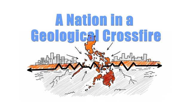
1. It’s Not Just the Ring of Fire; It’s a “Geological Crossfire”
While many know the Philippines is on the “Ring of Fire,” the reality is far more intense. The archipelago is trapped in a “geological crossfire,” wedged between the Sunda Plate (part of the larger Eurasian Plate) to the west and the Philippine Sea Plate to the east. This primary collision is intensified by the immense Pacific Plate to the northeast, which continually shoves the Philippine Sea Plate westward, creating a complex zone of compression.
To make this concept more accessible, imagine this: it’s like standing in the center of a four-way intersection where every car refuses to stop. Most countries contend with one or two tectonic boundaries. This constant, multi-directional pressure is why the nation is one of the most earthquake-prone on Earth, and why the islands don’t just shake—they also bend, twist, and rise under the immense strain. This immense pressure is not only crushing the archipelago; it created the primary release valve for this stress: a colossal fracture that runs down the nation’s spine.
2. The Archipelago Has a Massive Spine: The Philippine Fault
Running the entire length of the country is that colossal fracture in the Earth’s crust: the Philippine Fault system. This massive fault system, with estimates of its length ranging from 1,200 to 1,500 kilometers, runs from Luzon in the north to Mindanao in the south, comparable in scale to California’s famous San Andreas Fault.
However, the Philippine Fault has its own distinct characteristics. It is a left-lateral (sinistral) strike-slip fault, meaning the land on the opposite side of the fault moves to the left during a rupture. Furthermore, it is not a single, clean line. The system is a complex, multi-stranded network that bifurcates into at least four major branches in Northern Luzon, making it the source of many of the country’s most destructive historical earthquakes, including the devastating magnitude 7.7 earthquake in 1990. To grasp its modern-day impact, consider this: in the last 50 years alone, the Philippine Fault system has generated more than 60 earthquakes with a magnitude of 5.0 or greater—an average of more than one significant earthquake every year from this single fault system.
3. Earthquakes Can Trigger Others in a Decades-Long Chain Reaction
Earthquakes in the Philippines are not always isolated events. Decades of seismic monitoring and stress modeling reveal that these earthquakes are deeply interconnected. As one quake relieves tension on a fault segment, it also redistributes that stress, transferring the load to neighboring faults and potentially setting the stage for future events years or even decades later.
Coulomb stress transfer modeling provides clear examples of this phenomenon:
- The magnitude 7.7 Northern Luzon earthquake of July 1990 appears to have increased stress on the faults responsible for the magnitude 7.0 and 6.4 Abra earthquakes that occurred 32 years later in 2022.
- The magnitude 7.5 Ragay Gulf earthquake of 1973 seems to have promoted stress accumulation in Masbate, likely contributing to the triggering of magnitude 6.0 or greater events on the island in 2003, 2020, and 2023.
This reveals a profound and unsettling truth: the seismic story of the Philippines is written over generations, with the echoes of past quakes setting the stage for future events decades later.
4. The Greatest Danger May Lurk in the Quietest Places
A common assumption is that the areas that shake the most are the most dangerous. Geologically, the opposite can be true. Scientists are most concerned about “seismic gaps”—segments of major faults that have been suspiciously quiet for a long time.
This quietness is not a sign of safety. Instead, it indicates that stress is building up without the relief of small, periodic quakes. The fault is locked, accumulating energy for a major release.
Seismologists call this the silence before rupture, when a fault stops producing small quakes not because it’s calm, but because it’s lock tight.
Using Coulomb stress transfer modeling, scientists have identified several key segments that are being monitored closely due to their relative quiet and accumulated stress. These include:
- The Infanta Segment of the Philippine Fault, located approximately 60 kilometers from Metro Manila.
- The Southern Leyte Segment.
- The San Francisco, Agusan del Norte Segment in Mindanao.
5. Manila is Threatened by a “Sleeping Giant” at Sea
While residents of the capital are rightly concerned about the well-known, on-land threat from the West Valley Fault and the quietly accumulating stress on the nearby Infanta Segment of the Philippine Fault, a third, even larger danger lurks just offshore. The Manila Trench, a deep ocean trench in the South China Sea, is the country’s “sleeping giant.” It has been silent for centuries, yet it is loaded with tectonic strain.
Scientists warn that if the Manila Trench ruptures, the outcome could be catastrophic. It is capable of unleashing an earthquake potentially as large as magnitude 8.5—with some scientific models assessing tsunami scenarios from a magnitude 8.3 event—and sending a tsunami crashing toward Luzon, with the potential to reach Manila Bay in under 20 minutes. This is not the only such offshore threat. The Cotabato Trench has a dark history, having triggered a devastating tsunami in 1976 from a magnitude 7.6 Moro Gulf earthquake that killed over 8,000 people.
Conclusion: An Unpredictable Future
The recent doubling of microquake activity is not an anomaly; it is a reminder that the great geological machine beneath the islands never stops. The Philippines’ unique and intense seismic activity is the result of a complex geological battle. The islands are caught in a tectonic crossfire, sliced by a massive fault system where ruptures are interconnected, and where the most silent areas may pose the greatest threat. For the Philippines, earthquakes are a rhythm that has shaped the islands for millions of years. The question has never been if the ground will move, only where it will strike next. Understanding these five truths is the first step, not toward prediction, but toward preparation and resilience in a land that will never stand still. (Report by HKPinoyTV research team)


