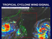
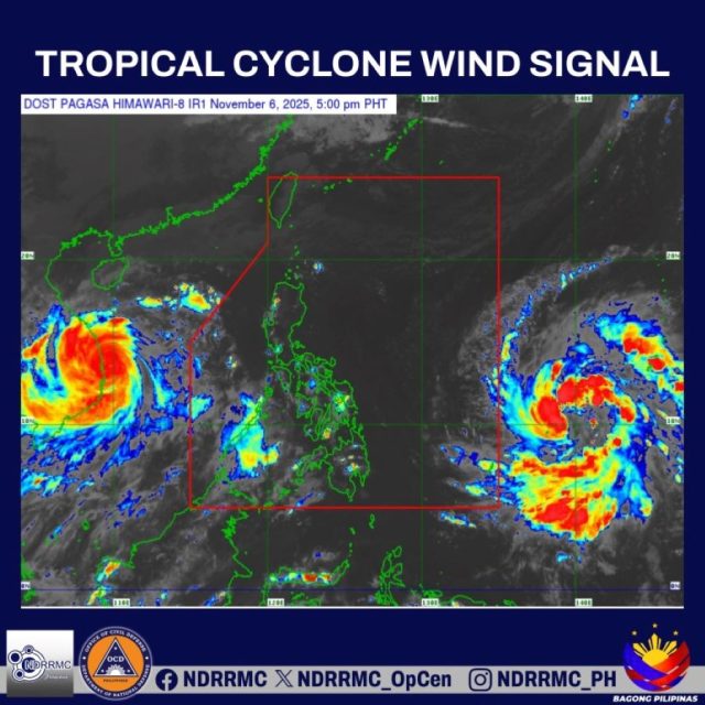
MANILA — Typhoon Uwan barreled into the Philippines’ area of responsibility late Friday, prompting weather officials to raise the lowest-level wind signal over dozens of provinces and islands while forecasting a potential super typhoon strike on northern Luzon by early next week.
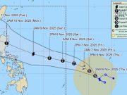
The Philippine Atmospheric, Geophysical and Astronomical Services Administration, or PAGASA, said in its 11 p.m. Friday bulletin that Uwan — known internationally as Fung-Wong — was located about 1,045 kilometers (650 miles) east of Eastern Visayas, with maximum sustained winds of 120 kph (75 mph) and gusts up to 150 kph (93 mph). The storm was drifting west-northwestward at 20 kph (12 mph).
Tropical Cyclone Wind Signal No. 1, indicating minimal to minor threat from winds of 30-60 kph (19-37 mph), was hoisted over eastern Isabela; eastern and southern Quirino; southeastern Nueva Vizcaya; Aurora; southeastern Rizal; eastern and southern Quezon including the Polillo Islands; Romblon; Marinduque; Camarines Norte; Camarines Sur; Albay; Catanduanes; Sorsogon; Masbate including Ticao and Burias islands; Northern Samar; Eastern Samar; Samar; Biliran; Leyte; Southern Leyte; northern and central Cebu including Bantayan and Camotes islands; northeastern Bohol; northern Negros Occidental; northern Iloilo; northeastern and western Capiz; Aklan; Dinagat Islands; and Surigao del Norte.
Higher signals could be issued as the typhoon closes in, PAGASA said, warning that Uwan may rapidly intensify into a super typhoon by late Saturday or early Sunday. That could lead to Signal No. 5, the highest alert level, signaling winds exceeding 220 kph (137 mph) and a “extreme threat to life and property.”
The storm is projected to slam into southern Isabela or northern Aurora at or near peak strength late Sunday or early Monday, PAGASA added. It would then carve across Northern Luzon before emerging into the West Philippine Sea by late morning or afternoon Monday. The island’s rugged mountains are expected to sap much of Uwan’s power, though it should retain typhoon status throughout.
Heavy rains were forecast to drench Luzon and the Visayas during the typhoon’s approach. Torrential downpours — potentially exceeding 200 millimeters (8 inches) — could hit Camarines Sur, Catanduanes and Albay from Saturday afternoon through Sunday, with heavy precipitation also likely in Cagayan, Isabela, Quirino, Aurora, Quezon, Camarines Norte, Sorsogon, Masbate, Northern Samar, Samar and Eastern Samar starting Saturday afternoon.
Widespread flooding and landslides loomed as major risks, particularly in Bicol from Saturday evening to Sunday evening and in northern and central Luzon from Sunday evening to Monday evening, PAGASA cautioned. “Severe flooding and landslides” were possible in highly vulnerable areas, the agency said.
The Japan Meteorological Agency issued even starker warnings, describing Fung-Wong’s trajectory as a “catastrophic threat” to Aurora and neighboring provinces in central and northern Luzon. The storm was undergoing rapid intensification and could reach “very strong typhoon” status by Saturday night, the agency said.
“Its large size will cause destructive winds and widespread, intense rainfall across a vast area of the island,” the JMA stated. Devastating gusts and downpours were expected in Aurora, northern Quezon and southern Isabela from Sunday night through Monday morning.
Central Luzon and the Cordillera Administrative Region could face strong winds, torrential rain, severe flooding and landslides starting Sunday night, while the Ilocos Region and Pangasinan might see gale-force winds and heavy-to-intense rains by Monday. The Bicol Region was bracing for strong-to-severe winds and heavy rain from Saturday evening.
Uwan’s broad circulation also was poised to amplify the northeast monsoon, or “amihan,” boosting rainfall along Luzon’s eastern coast and in mountainous zones like the Sierra Madre range, the JMA added.
Officials urged residents in at-risk areas to prepare evacuation plans and secure property, with local governments activating emergency response teams. The typhoon’s timing coincides with the tail end of the Pacific typhoon season, which has already battered the archipelago multiple times this year.


