Typhoon Tino, internationally known as Kalmaegi, held its intensity early Wednesday while traversing northern Palawan, prompting the highest storm alert in parts of the province and warnings of destructive winds, heavy rain and potential storm surges, the state weather bureau said.
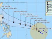
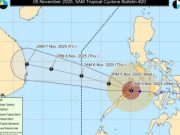
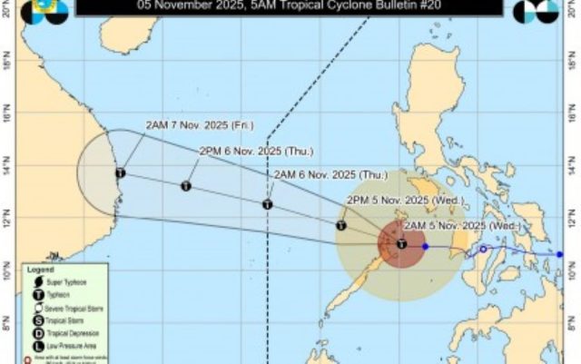
The Philippine Atmospheric, Geophysical and Astronomical Services Administration (PAGASA) estimated the typhoon’s center over the coastal waters of Linapacan, Palawan, at 5 a.m., with maximum sustained winds of 120 kilometers per hour near the center and gusts reaching up to 165 km/h. The storm was moving west-northwest at 15 km/h.
Typhoon-force winds extended outward up to 300 kilometers from the center.
Public Weather Storm Signal No. 4 — indicating winds of 118 to 184 km/h — was raised over the northernmost portion of Palawan, including El Nido, Taytay, Araceli and the Calamian Islands.
Signal No. 3 covered the northern portion of Palawan, including Dumaran, San Vicente and Roxas, as well as the Cuyo Islands, where storm-force winds of 89 to 117 km/h were possible.
Signal No. 2 was in effect for southern portions of Occidental Mindoro (Magsaysay, San Jose, Rizal and Calintaan) and Oriental Mindoro (Bulalacao), along with central Palawan, including Puerto Princesa City, and the Cagayancillo Islands, with expected gale-force winds of 62 to 88 km/h.
Areas under Signal No. 1, which may experience winds of 39 to 61 km/h, included the rest of Occidental and Oriental Mindoro, western Romblon, southern Palawan (Aborlan, Quezon, Narra and Sofronio Española), the Kalayaan Islands, Aklan, the rest of Antique, parts of Capiz and Iloilo, and the island province of Guimaras.
PAGASA warned of significant to severe impacts from typhoon-force winds in Signal No. 4 areas and moderate to significant impacts in Signal No. 3 zones.
Heavy rainfall was forecast over the MIMAROPA region and Western Visayas due to the combined effects of the typhoon, a shear line and the northeast monsoon, locally known as amihan. Residents in flood- and landslide-prone areas were urged to stay vigilant and follow evacuation orders from local authorities.
The surge of the northeast monsoon and Tino’s trough were also expected to produce strong to gale-force gusts across Luzon and the Visayas, especially in coastal and upland areas.
A gale warning remained in place over the western and southern seaboards of Southern Luzon and the seaboards of Western Visayas. Very rough seas up to 6 meters high were anticipated along the seaboards of northern Palawan, including the Calamian and Cuyo Islands, while rough to very rough seas up to 4.5 meters were possible over Antique, the Kalayaan Islands and the southern seaboard of Occidental Mindoro.
Sea travel was deemed risky for all vessels, and mariners were advised to remain in port.
PAGASA also cautioned that life-threatening storm surges exceeding 3 meters could hit coastal communities in Oriental Mindoro, Occidental Mindoro, Palawan and Antique within the next 24 hours.
The typhoon made landfall over Batas Island in Taytay, Palawan, around 4:10 a.m. It was expected to continue crossing northern Palawan before emerging over the West Philippine Sea later Wednesday morning.
Tino could re-intensify within 12 hours, reaching peak intensity before possibly exiting the Philippine Area of Responsibility by Wednesday night or early Thursday.
Authorities called on residents and disaster management offices in affected areas to take all necessary precautions, particularly in coastal and low-lying communities.


